
Collaborative Working in West Northamptonshire
 Local Authorities are increasingly sharing services and resources to save money. In the realm of Local Plans the most recent legislation and guidelines have made consultation between neighbouring Councils a cornerstone to ensuring that key development policies are sound when submitted to the Planning Inspectorate.
The establishment of Joint Planning Units (JPU) is one method of embedding wider consultation into the Local Plan process by creating a framework for collaborative working. Through the establishment of a JPU Councils can work in partnership to identify where to implement sustainable new developments and how to make best use of the natural and man-made resources available without restricting the scope of their examination and determination to individual administrative boundaries. Joint working combined with public and stakeholder consultations don’t necessarily guarantee decision-making is any easier. What they do create is more opportunity for consensus and transparency in the decision-making process, both in the minds of the public and of the Planning Inspectorate, and thereby deliver an evidence base for planning policy that is much harder to refute.
Hosted web-based technologies are ideally suited to supporting collaborative initiatives like JPUs. They provide a virtual office space for planning personnel from different Councils to work in. They deliver a consistent level of 24/7 access to data, like mapping and documents, and to the right kind of tools for working with that data, particularly in support of collaboration, consultation and iterative Local Plan development. Councils can collaborate and consult on Local Plans and their related policies, documents and publications without having to change internal IT arrangements or radically alter internal protocols and work-flows; they simply extend the user base to the hosted software and allocate the necessary roles and permissions to each partner in the project or process being undertaken. The hosted software environment also provides the platform from which to easily publish and disseminate the deliverables and outcomes of collective decisions and actions as well as providing tools and communication channels for residents and stakeholders to engage with their Council and its partners.
The West Northamptonshire Joint Planning Unit is one such example of this developing trend of joint working within the public sector and public domain. ;The JPU brings together Daventry District Council, Northampton Borough Council, South Northamptonshire District Council and Northamptonshire County Council into one strategic body and comprises of officers engaged in the task of preparing the documents for the Joint Local Development Scheme (LDS), and thereafter submitting them to the Joint Strategic Planning Committee for their consideration and approval.
In 2013 the West Northamptonshire JPU chose our OpusMap system to support their mapping requirements; OpusMap has been taken by the Unit under a 3 year SaaS licence. Although the JPU already uses a GIS it was felt that a dedicated and hosted web-based system for mapping would best serve their requirements as it could be easily integrated with documents and web-pages generated from their online consultation and document management system. OpusMap‘s simple but powerful CMS also allows access to the map data by non-technical as well as technical personnel because the software is accessed through a normal web browser. A hosted platform also means that the OpusMap system is easier to roll out to other users as the role of the JPU develops in tandem with the joint planning process it is spearheading.
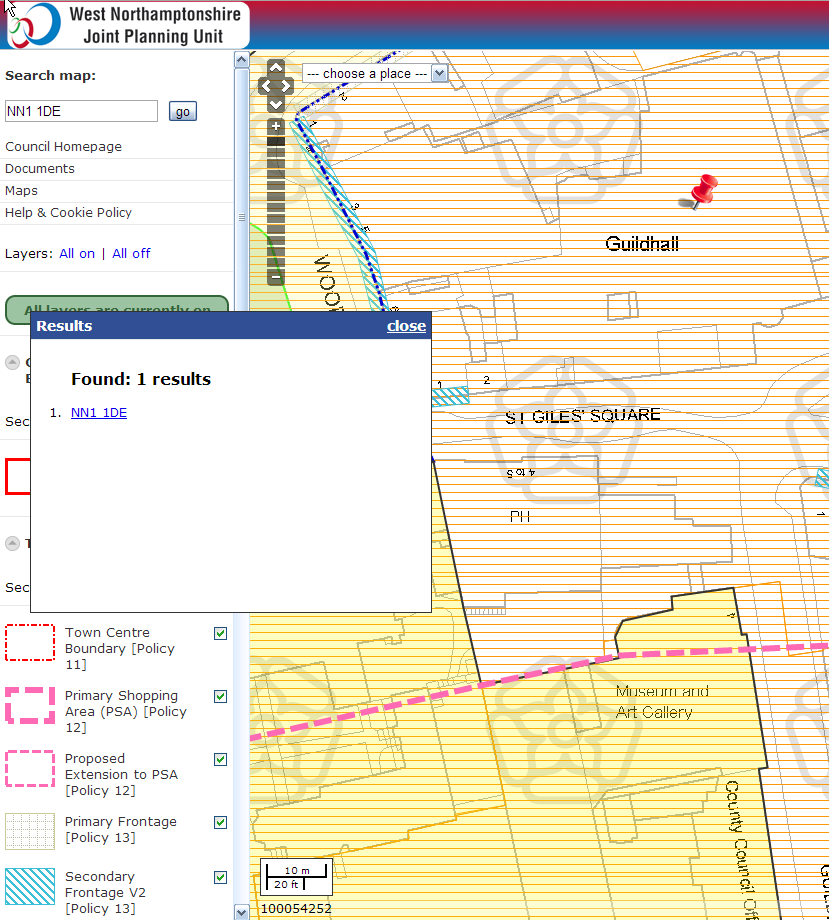
The first interactive map published from OpusMap is the Central Area Action Plan (CAAP) for Northampton Town centre. The map has been designed and developed by the JPU’s own officers using OpusMap‘s cartographic styling and layer management tools. The software supports multiple overlays and transparencies so all layers and base mapping, no matter how detailed or complex their arrangement on the map, are visible at all times. This gives the officers the freedom to determine the best styling and layering combinations for each map they publish thereby ensuring the information on the map is clear and unambiguous for the public to interpret. This is particularly important as the map is made up of data derived from a number of different sources and GIS. Ordnance Survey base mapping is provided via a WMS feed from Northamptonshire County Council’s own servers and address searching is from the JPU’s own gazetteer. The interactive map has 2-way links to the CAAP document generated from the JPU’s online document system thus allowing the public to more easily understand both the spatial and the textual context for each and every policy outlined in the Plan. This provides a high level of accessibility and transparency to the JPU’s programme of work for all stakeholders tasked with delivering to the requirements of the JPU’s mandate.
The interactive CAAP map can be accessed directly from the JPU website’s Home page if you click here or you can go straight to the map by clicking on the images.